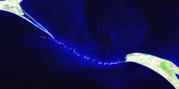
Historic First: Detailed Mapping of Ram Setu by ISRO Scientists
The Indian Space Research Organisation (ISRO) has recently created the most detailed map to date of Adam’s Bridge, more popularly known as Ram Setu. This submerged ridge connects Dhanushkodi in India to Talaimannar Island in Sri Lanka. The comprehensive mapping, conducted in collaboration with NASA, confirms that Ram Setu is indeed a continuous submarine ridge. Advanced Mapping Techniques Researchers from ISRO’s Jodhpur and Hyderabad National Remote Sensing Centres spearheaded this project, using data from NASA's ICESat-2 satellite. The satellite's laser beams bounced off the seafloor, revealing that 99.8 percent of Adam’s Bridge is submerged in shallow waters. "Our research confirms that Adam’s Bridge is a submarine continuation from Dhanushkodi to Talaimannar Island," the study published in Scientific Reports noted. Historical and Geological Significance Ram Setu, a chain of shoals between Mannar Island off northwest Sri Lanka and Rameswaram Island off southeast India, has long been believed to represent a former land connection between the two countries. Geological evidence supports this theory, and the new findings provide further confirmation. The study highlights an asymmetry of transverse slopes at the base of the bridge The Findings in Detail ISRO’s research revealed that the volume of Adam’s Bridge is approximately 1 km3. Interestingly, only 0.02 percent of this volume is above mean sea level, and this portion is visible in optical satellite imagery. In total, around 99.98 percent of the bridge is submerged in shallow and super-shallow waters. Previous satellite observations had confirmed the presence of this submerged structure but focused on parts elevated above water. Shallow sea depths had also hindered earlier attempts to map the bridge from ships. Source: Google images Innovative Use of Laser Technology This time, researchers utilized photons from ICESat-2’s green laser, capable of detecting the seafloor up to depths of about 40 meters. "Taking a cue from this potential, we accrued approximately 0.2 million photons representing depth information and generated 10-meter resolution bathymetric data for Adam’s Bridge," the study reported. To confirm the current physical features, scientists used visual interpretations from bathymetric data through 3D-derived parameters, including contours, slopes, and volumetric analysis. Discovering Hidden Channels A team led by Giribabu Dandabathula identified 11 tiny channels with depths of 2-3 meters and used 3D-derived metrics to estimate the bridge's physiology. This analysis provides a clearer understanding of the submerged structure and its complex geological history. Cultural and Historical Importance Until the ninth century AD, Persians referred to this bridge as 'Sethu Bandhai.' Ram Setu holds immense historical significance in Indian culture, believed to have been constructed by Lord Ram to reach Lanka (modern-day Sri Lanka) to rescue his wife Sita from the demon king Ravana, as described in the ancient epic Ramayana. Historically, the bridge was above sea level and served as a vital link until 1480 when a powerful storm caused it to become submerged. The collaborative efforts of ISRO and NASA have produced a significant leap in our understanding of Ram Setu. The detailed mapping confirms the bridge's continuity and highlights its complex geological features. This research enriches our historical knowledge and paves the way for future scientific exploration.

